Surveys
We specialize in Measured Building Surveying – Measured house Survey
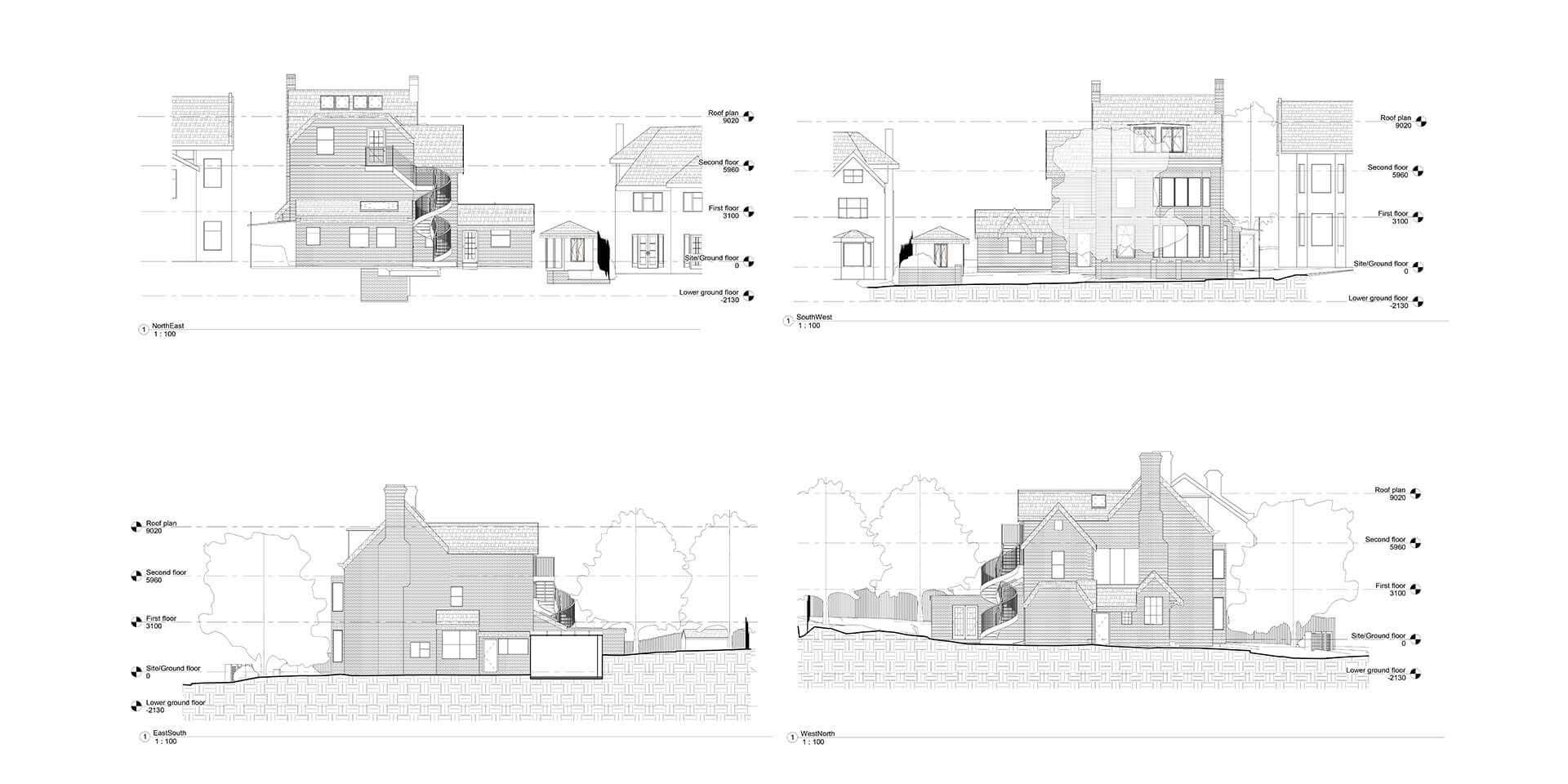
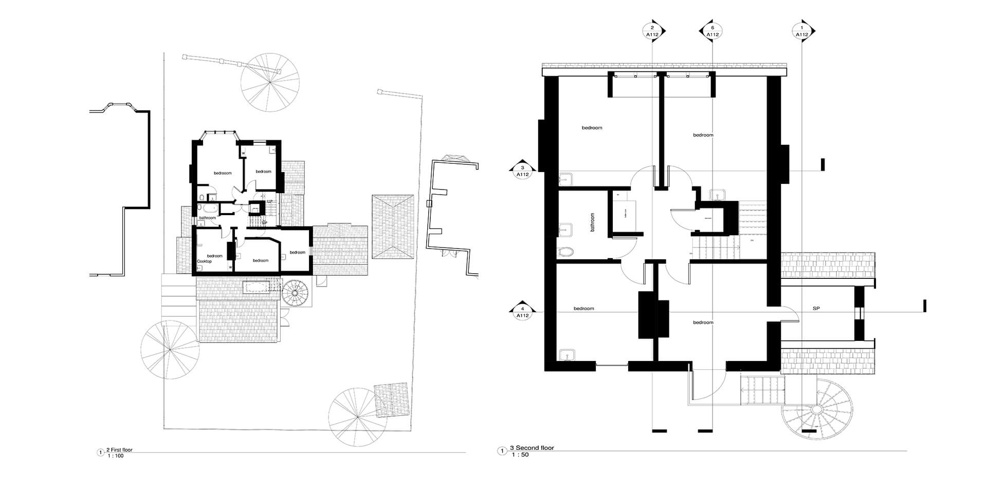
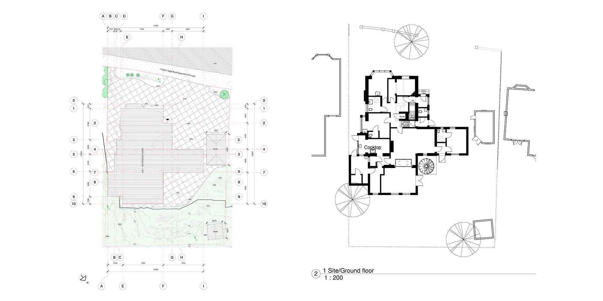
Preparing accurate plans of existing properties, sites and buildings.
This involves examining and recording the area and features of a site or building to construct a Floor or Roof Plan, Elevation or Section drawing and also Topography.
Measurements can be collected by hand or we can provide 3D scanning of buildings a variety of methods can be used to collect this data for your project:
-
Measurement collection by hand with laser Disto and Leica S910 for Point to Point data collection in hard reachable areas such as hight or roof measurements for elevation drawings Watch Video
-
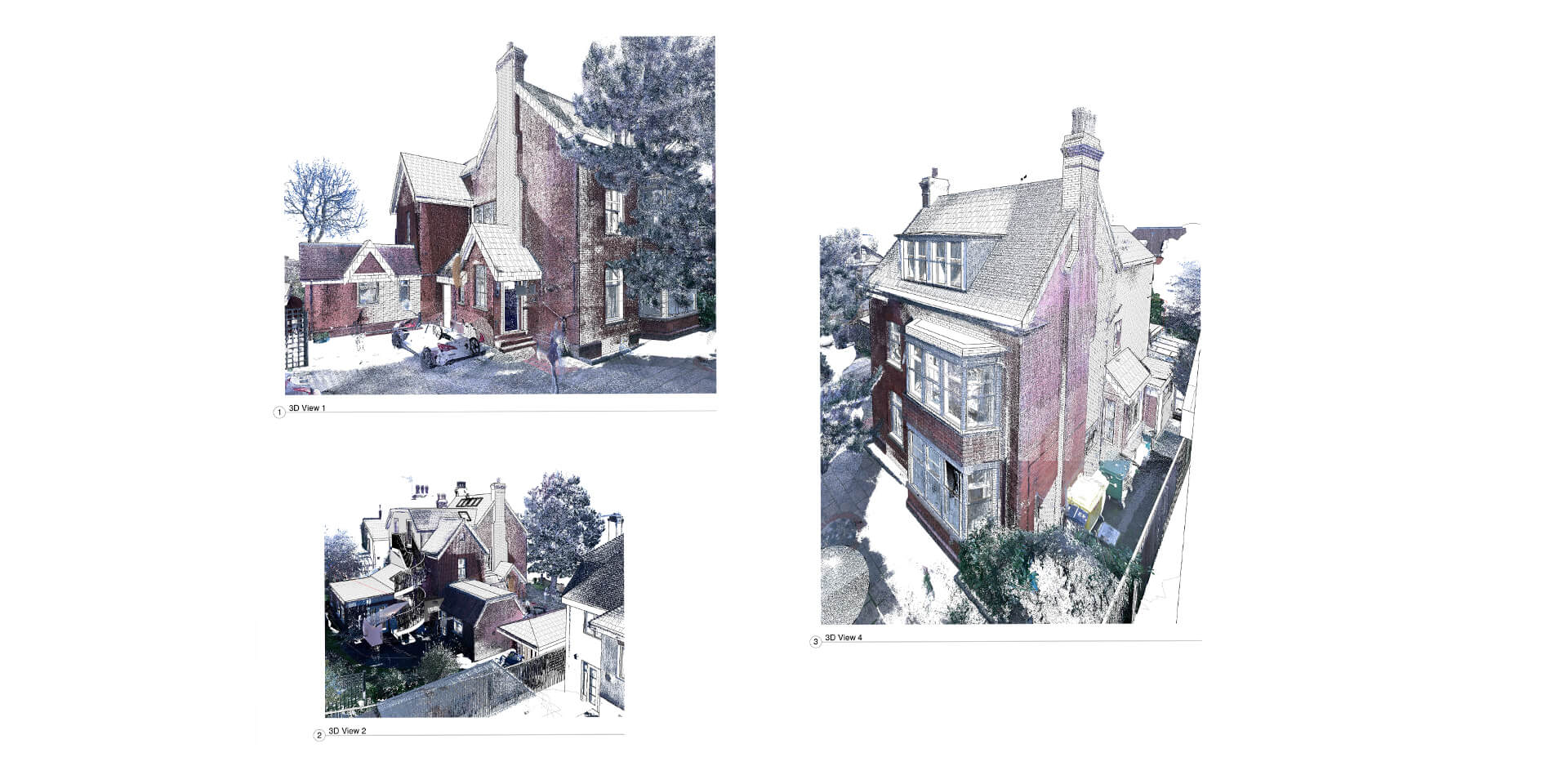
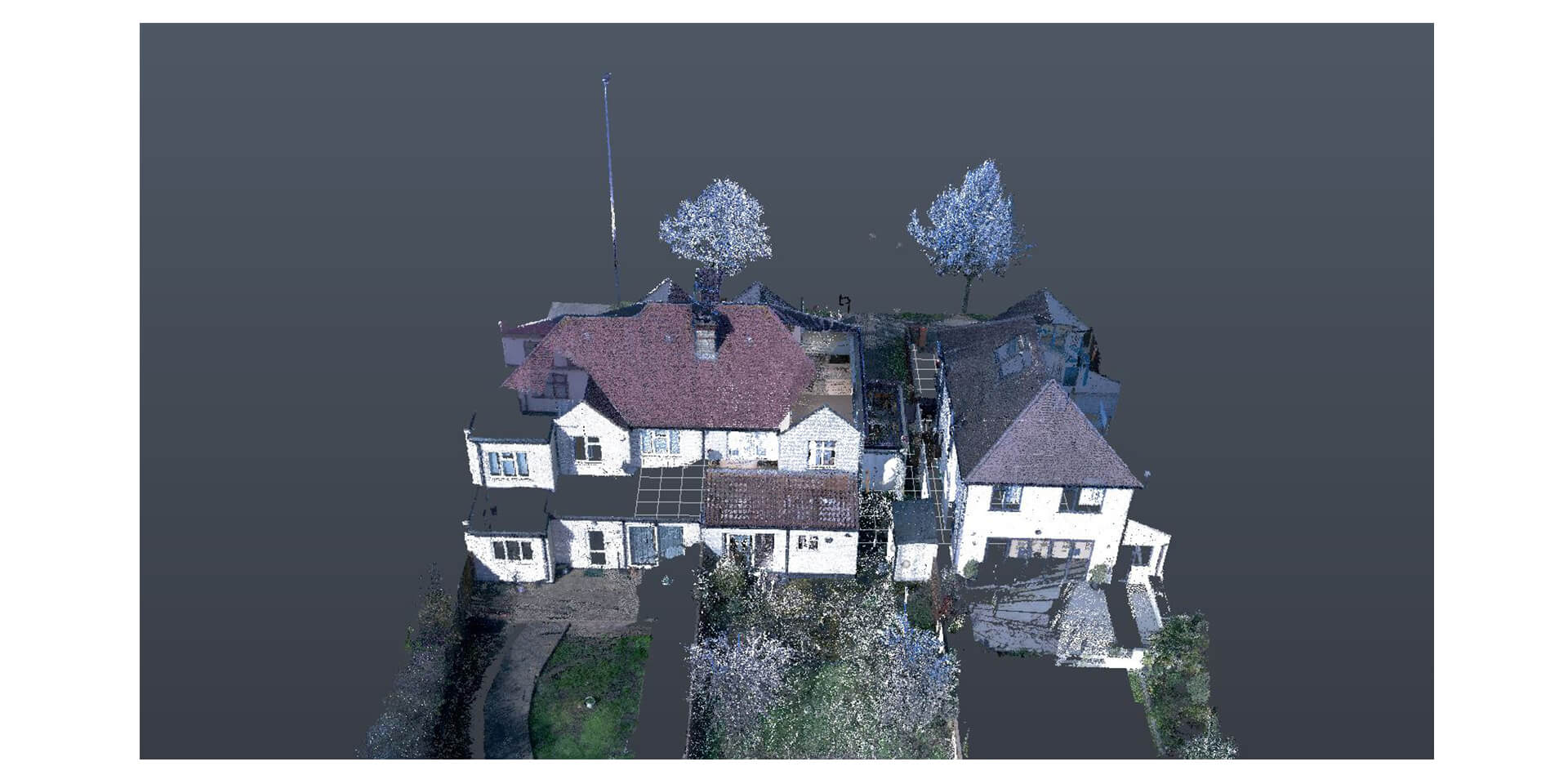
With Leica BLK360 we can cover large spaces, land, internal and external data collection in a Point Cloud, mapping your site in 3D Watch Video
-
With Matterport Pro 2 we scan Internally Residential properties only due to the type of laser it uses it is not able to work externally or capture large areas but internally works so much faster then BLK360 reflecting in more cost-efficient service to our clients. Watch Video
We always recommend using 3D scanning as it provides information on wall thickness, height and floor thickness with an accuracy of up to 99%. This gives you much greater precision, accessible as a Point Cloud information rather than hand sketch – Point Cloud is provided in RCP files as output.
Once surveying is done, the information can be added to AutoCAD or Revit to create final plans as required in PDF, DWG or other formats.
We have been using Point Cloud technology in our architectural practice for the past year and have never looked back.
We are very confident in the future of this methodology (including Point Cloud scanners in our business portfolio has been a great success).
How is the survey created?
SpacePhoto uses the latest cameras, such as the Leica BLK360, with built-in infrared lasers that not only produce flat images but gives accurate measurements and depth of the images. From this 3D module, we are able to create a range of files including Point Cloud, OBJ files, Revit and 3D AutoCAD.
Four reasons for Architects to use Point Clouds in their next project.
1. More information is better
Point cloud scanning technology provides a complete three-dimensional scan of the real environment capturing the data using millions of individual laser points.
2. Avoid revisits
Reduce the need of returning to the site to take the one missing measurement or to confirm what is just outside the limit of the photo fixation.
3. 3D Virtual tours
Will allow you to virtually visit the site, take measurements and explore as if you were there.
4. Capture difficult information.
We can capture difficult to reach information which would be impossible, dangerous or expensive to measure via other means.
How do I get in touch?
For more information about Surveys in London, please contact SpacePhoto today on 020 3287 6610 or by e-mail general@spacephoto.co.uk.